Earth Model
On October 8, 1909, an earthquake hit Kulpa Valley (Croatia) in Europe. Through collecting the copies of seismograms from many European stations, Andrija Mohorovicic built a traveltime-distance plot (Prodehl et al., 2013).
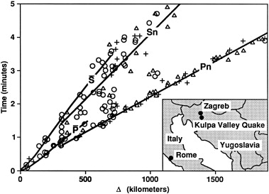
After analysing the seismic phases shown in the plot, he proposed (Jarchow & Thompson, 1989):” Since the P wave can only reach down to a depth of 50 km, this depth marks the limit of the upper layer of the earth’s crust. At this surface, there must be a sudden change of the material which makes up the interior of the earth, because there a step in the velocity of the seismic waves must exist.”
Since then, the Moho discontinuity is found to be a globally ubiquitous interface in the solid Earth, ranging from 5 to 8 km in oceanic regions and from 20 to 70 km in continental regions. The Moho manifests the highly differentiated Earth, across which the seismic velocity, density, refectivity, rheology, magneticity and petrology change rapidly.
Formal definition of seismic Moho (Jarchow & Thompson, 1989)”: The Moho discontinuity is defined as that level in the Earth where the compressional wave velocity increases rapidly or discontinuously to a value between 7.6 and 8.6 km/s. In the absence of an identifiable increase in velocity the Moho discontinuity is taken to be the level at which compressional wave velocity first exceeds 7.6 km/s.
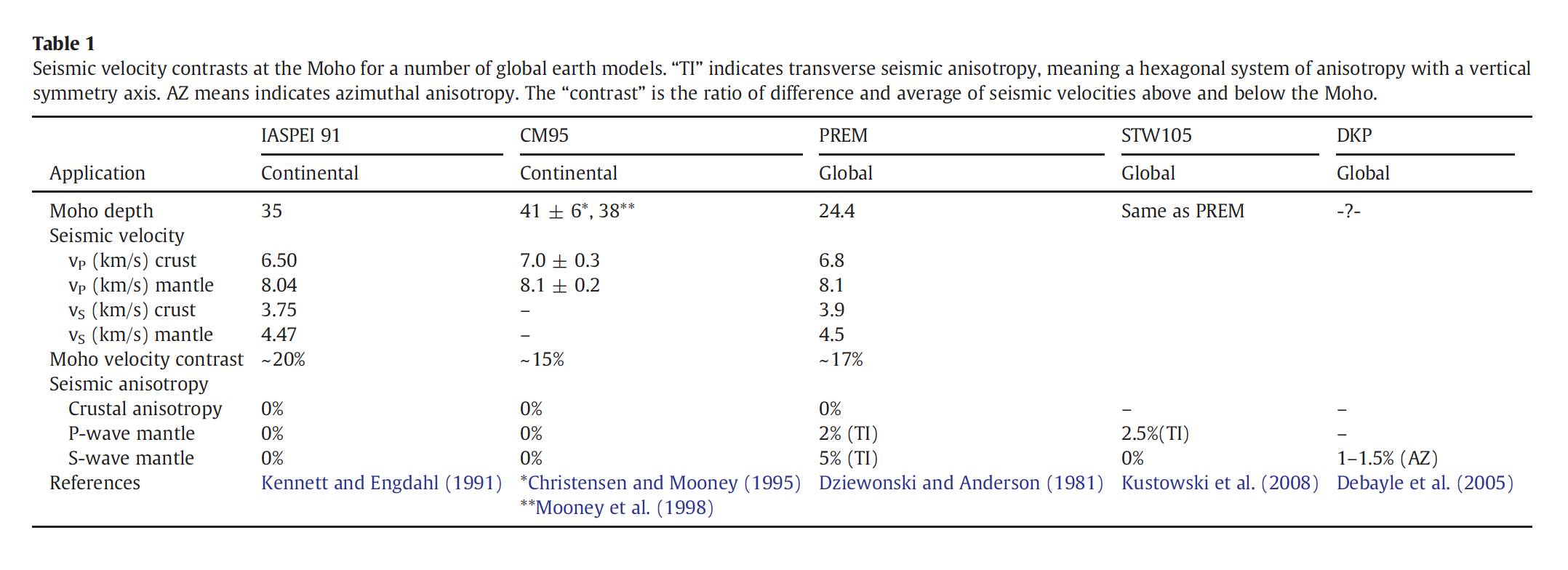
The P-wave velocity contrast across Moho can be more than 15% in various Earth models (Rabble et al., 2013):